
Remote sensing for the environment lets you monitor large areas quickly using satellite imagery with high detail. It helps you spot land use changes, water quality shifts, and ecosystem health over time, all without physically visiting sites. You can detect subtle environmental changes, track seasonal patterns, and analyze trends to guide conservation efforts. As technology advances, satellite data becomes more accessible and detailed, opening new opportunities for effective environmental management—so, explore further to uncover more capabilities.
Key Takeaways
- Remote sensing uses satellite imagery to monitor environmental changes over large areas quickly and cost-effectively.
- It detects land use changes, deforestation, water quality, and natural disasters with high spatial and temporal resolution.
- Data visualization and layering enable analysis of complex phenomena like pollution, climate impact, and habitat loss.
- Technological advancements have improved image detail, making small-scale environmental features easier to analyze.
- Remote sensing supports decision-making, policy development, and public awareness for sustainable environmental management.
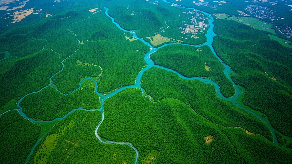
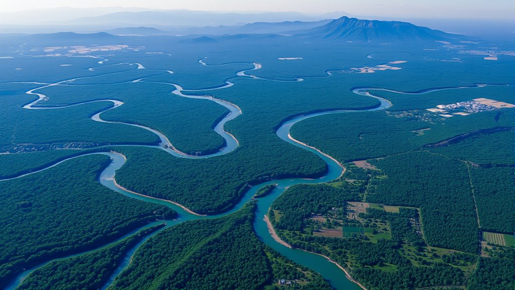
Remote sensing has become an essential tool for monitoring and understanding our environment. When you utilize satellite imagery, you gain a powerful perspective that traditional methods simply can’t match. Satellite imagery provides high-resolution images that cover vast areas quickly, allowing you to observe changes over time with remarkable detail. This capability is invaluable for environmental monitoring, as it helps you track deforestation, urban expansion, water bodies, and natural disasters in real-time or through historical data. Instead of physically visiting every location, you can analyze satellite images from your computer, saving time and resources while gaining extensive insights.
Utilize satellite imagery for detailed, efficient environmental monitoring and quick insights without the need for physical site visits.
With satellite imagery, you can detect subtle changes in land use, vegetation health, and water quality that might otherwise go unnoticed. For example, you might notice a gradual decline in forest cover in a remote region, signaling illegal logging or natural degradation. You can also monitor seasonal variations, such as crop growth cycles or snow cover, helping you plan resource management more effectively. This kind of environmental monitoring supports decision-making at local, national, and global levels, enabling you to respond quickly to emerging threats or issues. By regularly analyzing satellite images, you’re able to establish baselines and identify trends over years, making your environmental evaluations more accurate and reliable.
Furthermore, satellite imagery enhances your ability to visualize complex environmental phenomena. You can overlay data layers, such as climate models or pollution levels, onto satellite images to understand how different factors interact. This integrated approach helps you pinpoint areas most vulnerable to climate change or pollution, guiding targeted interventions. The accessibility of satellite imagery, often available through open sources or commercial providers, means you can incorporate cutting-edge data into your projects without excessive costs. This democratization of data allows a broader range of organizations and individuals to participate in environmental monitoring efforts. Additionally, advancements in satellite technology have improved spatial resolution, enabling even more detailed analysis of small-scale environmental features.
As you become more familiar with satellite imagery, you’ll realize its potential for supporting sustainable development and conservation initiatives. It empowers you to make informed decisions, advocate for policy changes, and raise public awareness. Whether you’re tracking deforestation in the Amazon or assessing coastal erosion, satellite imagery provides the essential visual evidence needed to drive meaningful action. Ultimately, by leveraging satellite imagery for environmental monitoring, you gain a clearer, more extensive understanding of our planet’s health, ensuring that you can contribute to its preservation and sustainable future.
Frequently Asked Questions
How Does Remote Sensing Impact Climate Change Mitigation Strategies?
Remote sensing helps you combat climate change by providing detailed data to diminish your carbon footprint and monitor biodiversity. You can track deforestation, land use changes, and greenhouse gas emissions more accurately. This technology enables you to make informed decisions, prioritize conservation efforts, and implement effective mitigation strategies. By continuously monitoring ecosystems, remote sensing guarantees you stay ahead of environmental threats, ultimately supporting sustainable development and climate resilience.
What Are the Limitations of Satellite Resolution in Environmental Studies?
You’ll find that satellite resolution limits your ability to capture fine spatial detail, making it harder to analyze small environmental features accurately. Additionally, spectral resolution can restrict your capacity to distinguish between different land cover types or detect subtle changes. These limitations mean you might miss critical data for precise environmental assessments, requiring you to complement satellite imagery with other methods for an all-encompassing understanding.
How Can Remote Sensing Data Be Integrated With Ground-Based Observations?
Imagine opening hidden insights by combining remote sensing data with ground-based observations. You can achieve this through data fusion, blending satellite imagery with on-the-ground measurements for richer analysis. To guarantee accuracy, apply calibration techniques that align these datasets seamlessly. This integration reveals a more complete picture, enhancing your understanding of environmental changes. Don’t miss the opportunity—by linking these methods, you elevate your research to new levels of precision and discovery.
What Ethical Considerations Are Involved in Environmental Remote Sensing?
You need to consider data privacy when using remote sensing data, ensuring that sensitive information about individuals or communities isn’t exposed or misused. Also, be mindful of cultural impacts, respecting local traditions and land rights, especially in indigenous areas. By addressing these ethical issues, you help promote responsible environmental monitoring, balancing technological progress with respect for privacy and cultural integrity.
How Accessible Are Remote Sensing Tools for Developing Countries?
They say “necessity is the mother of invention,” and remote sensing tools are becoming more accessible, but cost barriers still exist for developing countries. You might find data accessibility limited due to high costs and technical expertise gaps. While some satellite data is free, advanced tools often require investments. Improving affordability and training can bridge these gaps, making remote sensing more inclusive and empowering you to address local environmental challenges effectively.
Conclusion
Think of remote sensing as your eagle eye in the sky, effortlessly soaring above the world, capturing hidden details and revealing secrets beneath the surface. Just as an eagle surveys its territory, you can monitor ecosystems, track changes, and protect the environment with precision and clarity. Embrace this powerful tool, and you’ll become a vigilant guardian of our planet, always one step ahead—seeing what others might miss, ensuring the earth’s health for generations to come.

As a valuable member of the Two Green Leaves team, Julia’s expertise in sustainable living and their ability to convey complex concepts in a relatable manner make them an invaluable asset. Their passion for the environment and their dedication to empowering individuals to embrace green practices make them a driving force behind our platform’s mission.